© P.Williamson

Weather in Provence
Get the latest Provence weather forecasts
Provence enjoys hot, sunny summers and mild winters, similar to that of other Mediterranean areas and the Côte d'Azur.
Located in southeastern France, Provence extends from the left bank of the lower Rhône to the west and the Italian border to the east, bordered by the Mediterranean to the south. There are various micro-climates throughout the region, and winds are a key feature of the weather here, particularly the mistral - a cold, dry wind which, especially in winter, blows down the Rhône Valley, often reaching windspeeds of over 100km/hour wreaking havoc to anything in its path.
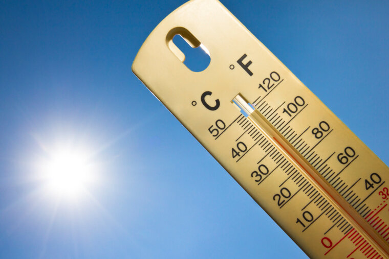
Monthly temperatures
Temperatures tend to average around 30°C (86°F) during the summer and fall to an average of 15°C (59°F) during winter. The infamous Mistral wind can have a great effect on the temperatures, particularly in the western part of Provence.
July and August are simmering hot with little-to-no rainfall. Temperatures tend to climb into the thirties (Celsius) during the day, when a siesta becomes a necessity rather than a luxury. At night it cools off considerably, especially on the coast, near a lake or in the mountains. In general, the farther away from the coast the more oppressive the heat becomes during the day. In the Vaucluse, for example, August can be a challenge.
The months before and after the high season are the most pleasant, May, June, September, October. The air is crisp, the temperatures in the twenties (Celsius). October is the most uncertain month of the four, but of course it can also be a splendid month with warm, sunny days and practically no rain. With the colder temperatures comes the chimneys emitting smoke from fireplaces. Locals brace themselves for the upcoming electricity bills that will reflect their usage of electric radiators. But this bleak weather is not a constant: there are many days in winter when the sun is inviting enough to have a lunch outdoors. February, in particular, can delight with balmy days.

Rainfall
Rainfall is infrequent and averages around 60 days each year, most of this falls in late autumn during October and November. Some years it breaks in with violent rains. Statistically, October has the most rainfall of the year, with November coming a close second. And when it rains in Provence, it pours. A veritable deluge that carries mud, rocks and broken tree branches onto the rural roads. Torrential rain can also occur during the summer months, particularly in the coastal areas where warm and cold pockets of air clash to produce downpours.
During the darker months of November until March one can expect rough rainstorms - necessary to secure the water supply for the warm and dry season.
Snow is a rare phenomenon in Provence (outside the high-altitude ski resorts in the Alpes-Maritimes, such as Valberg or Isola 2000). When it happens, it is a mere dusting of the surfaces, lasting just a few hours. Enough time to take a unique picture. When heavy snow does fall, the local services can struggle to cope (a bit like the UK). Major parts of the Autoroute du Soleil have been known to be inaccessible for several days. Snowploughs can of course be summoned from the lower Alps in these rare events.

Winds
Apart from rain and a little snow, Provence receives a weather curse by the name of the Mistral. It is a ferocious wind that originates in the Alps and barrels down the Rhône valley towards the Mediterranean sea, gaining speed and strength along the way. Gusts can reach over 100km per hour and can cause widespread damage to crops. Many farmers planted rows of Cypress trees to protect their crops from the wind which is why you will see so many of these trees scattered around Provence. Spreading out left and right, it reaches Nice as well as Montpellier. It is considerably less strong in Nice than in Arles or Avignon, which lie right in its path. A low pressure in the gulf of Genoa is a sure sign of the upcoming event. People brace themselves for the onslaught. When it happens, everyone gets cranky and blames their misfortunes of the day on the wind. As the saying goes: "Si le vent se lève le vendredi, il va jusqu'à la messe du dimanche" (If the wind starts on Friday, it ends before mass on Sunday!)
It is formed when an area of high pressure meets an area of low pressure – this causes a flow of cold air to be sucked down from high altitudes which then follows the valley systems southwards down to the Mediterranean. The wind plays most havoc during the winter when it can blow for several weeks at a time, although there can be shorter episodes throughout the year, where the wind can blow for a day or two. The great benefit of the Mistral is the clear skies that follow. All the dust and pollution is blown away out to sea, leaving crystal clear blue skies that Provence is so famed for. This clarity of light is also a reason why many of the great artists have been drawn to paint the region. The Mistral affects the western part of Provence most strongly, but it can be funnelled towards the east through the hilly countryside to affect all areas. When the Mistral blows along the coastline, it can significantly reduce the temperature of the sea – so beware of cooler waters after the Mistral has visited! You may also notice that many of the traditional farmhouses were built facing south east, so that the rear of the house took the full brunt of the Mistral. Note too that church clock towers tend to have open grills surrounding their bells, which allows the Mistral to pass through without causing too much damage