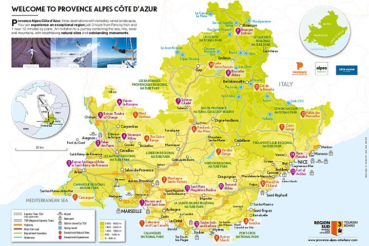
Provence is a historical province of south eastern France, extending from the lower Rhône River on the west to the Italian border on the east, in the south it is bordered by the Mediterranean Sea.
Made up of the the departments of Var (83), Bouches-du-Rhône (13), Alpes-de-Haute-Provence (04) and parts of Alpes-Maritimes (06) and Vaucluse (84). 
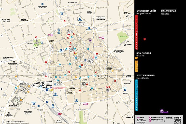
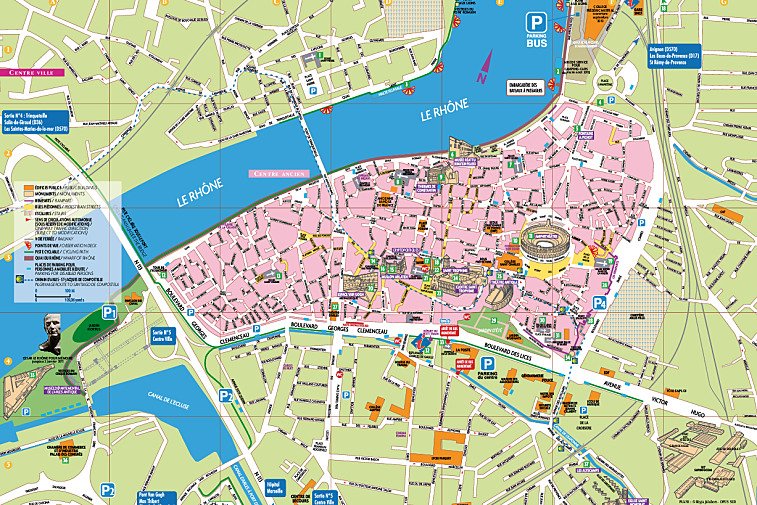
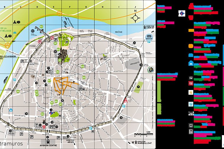
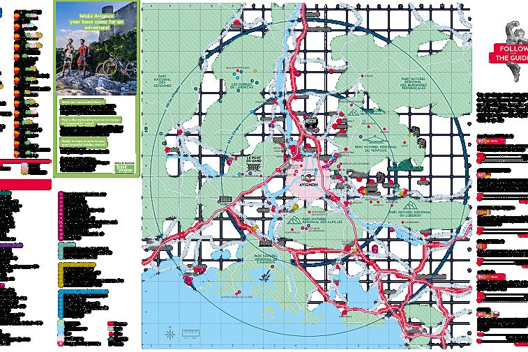
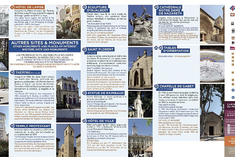
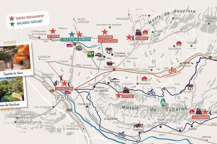
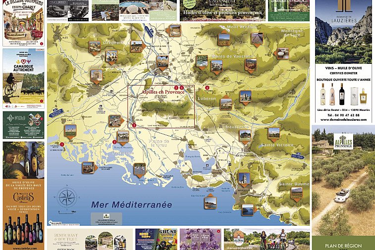
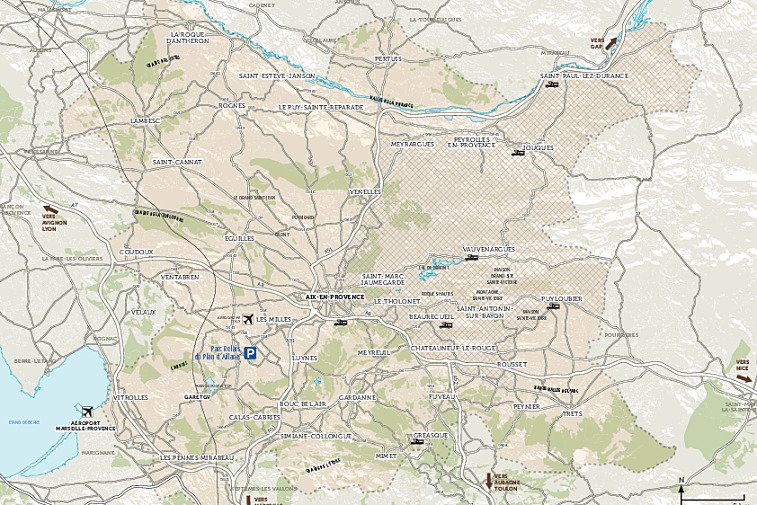
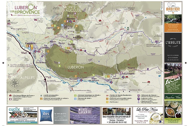
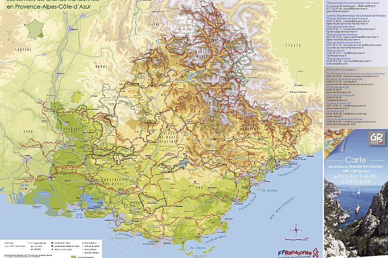
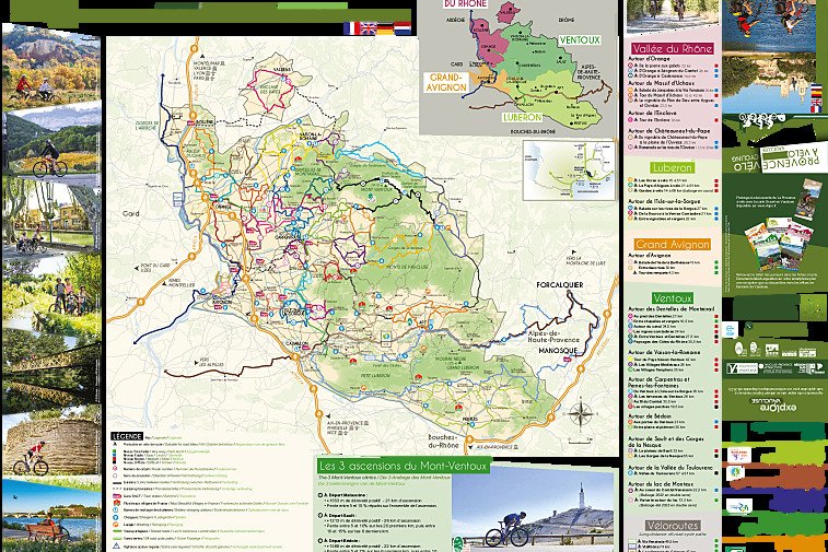
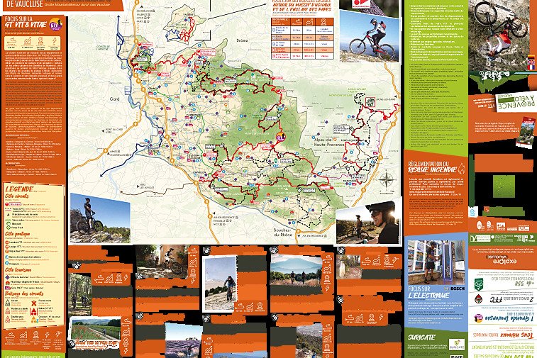
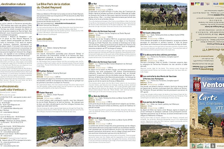
Below you can find several activities maps and trail maps from around the region.
These maps are available from most Tourist Offices, hotel receptions and the like, so there's no need to print them out.
Hiking & walking Maps
Beaumont de Ventoux - Discovery Walk
Beaumont-du-Ventoux - Chapels Walk
Bedoin - Combe de Malaval Walk
Cabrieres d'Aiguies to Etang do la Bonde Lake Walk
Cabrieres d'Avignon and the Surrounding Area Walk
Caromb - Olive Mill Walk
Caromb - Heritage Walk
Gordes - Bories & Senancole Walk
Gordes - Olive Mill Walk
Lagnes - Botanical Trail
Le Beaucet - Saint Gens Spring Walk
Le Baucet - Architecture & Spring Walk
Malaucene - Les Rochers des Rams Walk
Malaucene - Chapel Discovery Walk
Merindol - Olive Mill Walk
Mormoiron - Sands Orienteering
Mornas - Fortress Walk
Monieux - Conque Verte Walk
Monieux - Chapel Discovery Walk
Monieux - Saint-Hubert Botanical Trail
Rustrel - Colorado Provencal Walk
Oppede - Circuit Walk
Oppede - Olive Mill Walk
Sault - Defends Woods Walk
Sault - Lavender Trail Map
Sault - Durefort Tower Walk
Saumane-de-Vaucluse - Circuit de Marcouly Walk
Roussillon - Ochre Trail
Vacqueyras - Vineyard Walk
Valreas - Papal Milestone Walk
Velleron - Tour de Peigros Walk
Venasque - Petit Defend & Peregrine Walk
Vaucluse & Luberon Walking Routes Map